Mountain Biking
Discover all the best places to ride –The Lake Tahoe Bicycle Coalition provides extensive information including a full Lake Tahoe Bike Trail Map.
Please click Lake Tahoe Bicycle Coalition
Enjoy!
Rentals
Anderson`s Bicycle Rental
South Lake Tahoe: (530) 541-0500
Camp Richardson Resort & Marina
South Lake Tahoe: (530) 542-6584
Flume Trail Mountain Bikes
Flume Trailhead: (775) 749-5349
Lakeview Sports Bike & Jet Ski Rental
South Lake Tahoe: (530) 544-0138
Sierra Cycle Works
South Lake Tahoe: (530) 541-7505
South Shore Bike Shop
South Lake Tahoe: (530) 541-1549
Tahoe Bike Shop
South Lake Tahoe: (530) 544-8060
Paved Bike Paths

Pope-Baldwin Bike Path – Starting south of Emerald Bay at the Pope-Baldwin Beach the flat 3.4 mile path meanders south past beautiful Camp Richardson, the Tallac Historic Site and Fallen Leaf Lake.
South Lake Tahoe Bike Path – The South Lake Tahoe Bike Path starts where Hwy. 50 first touches Lake Tahoe at El Dorado Beach and connects to other bike trails and lanes throughout the city of South Lake Tahoe and into Nevada. Part of the trail bridges over Trout Creek and the Upper Truckee River just south of the lake.
Mountain Bike Parks
Kirkwood Mountain Bike Park
Kirkwood`s lift-accessed Mountain Bike Park opens in July (weather permitting) and closes in September. Hours are from 9am to 4pm Saturday and Sunday 209-258-7360
Northstar At Tahoe Mountain Bike Park
(530) 562-1010 or (800) GO-NORTH
Sugar Pine Point State Park is a forested promontory on the western side of Lake Tahoe. Trails serve almost every part of the park. A short loop trail through the Z`Berg Natural Preserve, the Dolder Trail follows the lakeshore and passes the world`s highest working lighthouse. For those with more time, the General Creek Trail is a 6 1/2 mile loop, offering an optional side trip to Lily Pond. Lost Lake, a beautiful alpine lake, is a full 15 mile round trip, and should only be tackled by seasoned hikers with ample time (6 to 7 hours).
Mountain Biking Trails
Fountain Place
This area has several mountain biking opportunities, from paved roads to more difficult trails. Note! Mountain bikes are not allowed past the gate at the end of Fountain Place Road nor the High Meadows area (private property). From U.S. HWY 50 take Pioneer Trail one mile to Oneidas Road. Follow Oneidas to the end and park at the staging area.
Fountain Place
Easy / Moderate
Elevation 6320` / 8400`
2 to 10 miles
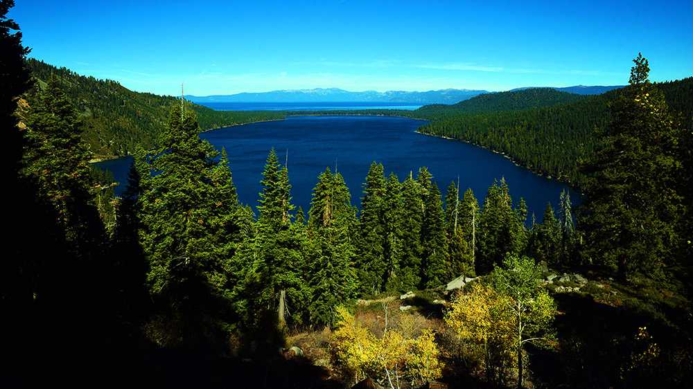
Angora Ridge
Enjoy a moderate ride with spectacular views of Fallen Leaf Lake and Mt. Tallac. Take Fallen Leaf Lake Road from SR 89. Park past the campground on the right. Ride along Fallen Leaf Lake Road, take the first left, continue one-half mile and turn right on Angora Ridge Road 12N14
Angora Ridge
Moderate
Elevation 6360` / 7440`
2 miles to Angora Lookout
4 miles to Angora Lakes
Twin Peaks
Perfect for the biker with limited time, this short steep ride to the top of a mountain peak has great views of Lake Tahoe. Open for public use from 9:00 a.m. to 7:00 p.m. daily. Access is off of Lake Tahoe Boulevard approximately two miles from the intersection of U.S. HWY 50 and SR 89. Caution! This area is a very popular off-highway vehicle area
Twin Peaks
Moderate / Strenuous
Elevation 6400` / 7010`
1 to 2 miles
Meiss Trail
Rising abruptly from SR 89 for the first half-mile, this trail levels off as it reaches Big Meadows. Trails leading to Round, Scotts and Dardanelles lakes provide access into Meiss Country with views of aspen-covered hills from lodgepole-cloaked forests. Note! This trail eventually intersects the Pacific Crest Trail (PCT) where mountain bikes are not allowed. Take SR 89 south from Meyers to the Big Meadows parking lot. Follow the trail at the southern end of the parking lot which leads across the highway to the trailhead.
Meiss Trail
Moderate / Strenuous
Elevation 7280` / 8400`
5 miles
Rim Trail
Experience breathtaking scenery with exceptional views of Lake Tahoe. Take the Rim Trail past Freel Peak, the highest peak in the basin (10,881`). Take SR 89 south from Meyers to the Big Meadows parking lot. The trail starts at the north end of the parking area. A longer trip is possible by taking two cars and parking one car at the Heavenly Ski Resort`s Stagecoach parking lot. The trailhead begins one-eighth mile up Stagecoach Run. Note! Mountain bikes are not allowed on the trail from Armstrong Pass north to Fountain Place, nor from Star Lake north to High Meadows (private property).
Rim Trail
Moderate / Strenuous
Elevation 7280` / 9600`
18 miles
Mr. Toad’s Wild Ride
A technical ride for the experienced mountain biker, this trail drops from 9,000` to 6,800` feet in three miles! Take the Rim Trail from the Big Meadows parking lot two and one-half miles to Tucker Flat. Turn left and follow the drainage of Saxon Creek. In two miles the trail forks again. The right fork leads to Oneidas Street off of Pioneer Trail. The left fork leads to SR 89, south of the SR 89 & U.S. HWY 50 junction. Watch for hikers and equestrian riders on the trail and pass with caution and courtesy.
Mr. Toad’s Wild Ride
Technical / Strenuous
Elevation 6800` / 9000`
3 miles
Genoa Peak
Enjoy a moderate ride along a ridgeline with scenic views of the Lake Tahoe Basin to the west and the Carson Valley to the east. Several spurs off the main road access peaks with Genoa Peak being the highest (9,150`). An excellent ten-mile loop off the main ridge is possible. Note! Mountain bikes are not allowed on the Rim Trail, from SR 207 to Spooner Summit. From South Lake Tahoe, take Kingsbury Grade (SR 207) and turn left on North Benjamin Road, which turns into Andria Drive. Continue to the end of the pavement and park. Take Genoa Peak Road 14N32. A longer trip is possible if you take two cars. Park the second vehicle off of U.S. HWY 50 behind the Nevada Department of Transportation Station, one-fourth mile south of the SR 28 and U.S. HWY 50 junction.
Genoa Peak
Moderate
Elevation 7720` / 8680`
8 to 12 miles
Brockway Summit to Martis Peak
The Martis Peak Road is a short five-mile climb well worth the effort. Drive north on SR 267 from Kings Beach to Brockway Summit. Park one-half mile past the summit on Forest Service Road 18N02.
Brockway Summit to Martis Peak
Moderate / Strenuous
Elevation 7120` / 8660`
5 miles
McKinney – Rubicon Road
This world-class off-highway vehicle road offers a variety of biking opportunities from loop rides to difficult peak climbs. From SR 89 north of Tahoma, turn west onto McKinney-Rubicon Springs Road. Turn left on Bellevue, right on McKinney Road, bear left onto McKinney-Rubicon Springs Road, continue to the dirt road and park. A longer ride is possible by taking two cars and parking one car at Blackwood Canyon.
McKinney / Rubicon Road
Moderate / Strenuous
Elevation 6400` / 7200`
6 to 15 miles
Marlette Lake / Flume Trail
Located in Lake Tahoe Nevada State Park, this popular trail is often crowded in the summer. Challenging even the expert rider, the trail begins east of the picnic area near Spooner Lake. Turn left on the dirt road that heads toward the meadow and follow a sandy road for five miles to Marlette Lake. Turn left across the dam. With magnificent views of Lake Tahoe, this single-track trail lies 1,500 feet above the lake. Remember to wear your safety helmet. Caution! Do not attempt this route if you are afraid of heights or unfamiliar with your bike. The trail ends at Tunnel Creek Road. To make a loop, turn right and ride to the top of the ridge. You will reach Twin Lakes in one-half mile. Seven-tenths of a mile past the lake sign, turn right or continue to the next main road and turn right. Turn right again on Forest Service Road 504, climb the ridge and where the road forks, continue straight to Marlette Lake. Take SR 28 to the Spooner Lake parking lot at Lake Tahoe Nevada State Park. A parking fee is charged. If you take two cars, be advised that limited parking is available at Tunnel Creek Road by the Ponderosa Ranch.
Marlette Lake & The Flume Trail
Strenuous
Elevation 7000` / 8300`
5 miles to Marlette Lake
23-mile loop Flume Trail
For additional information about mountain biking in the Lake Tahoe Basin, call, write or visit:
USDA -Forest Service
Lake Tahoe Basin Management Unit
35 College Drive
South Lake Tahoe, CA 96150
530-543-2600